Interactive views you can poke at
A time-scrubbed map, a network you can pivot, a layered chart with toggles. Each atlas lets you find the same period or place across multiple lenses, with the data behind it one click away.
Knowledge graph
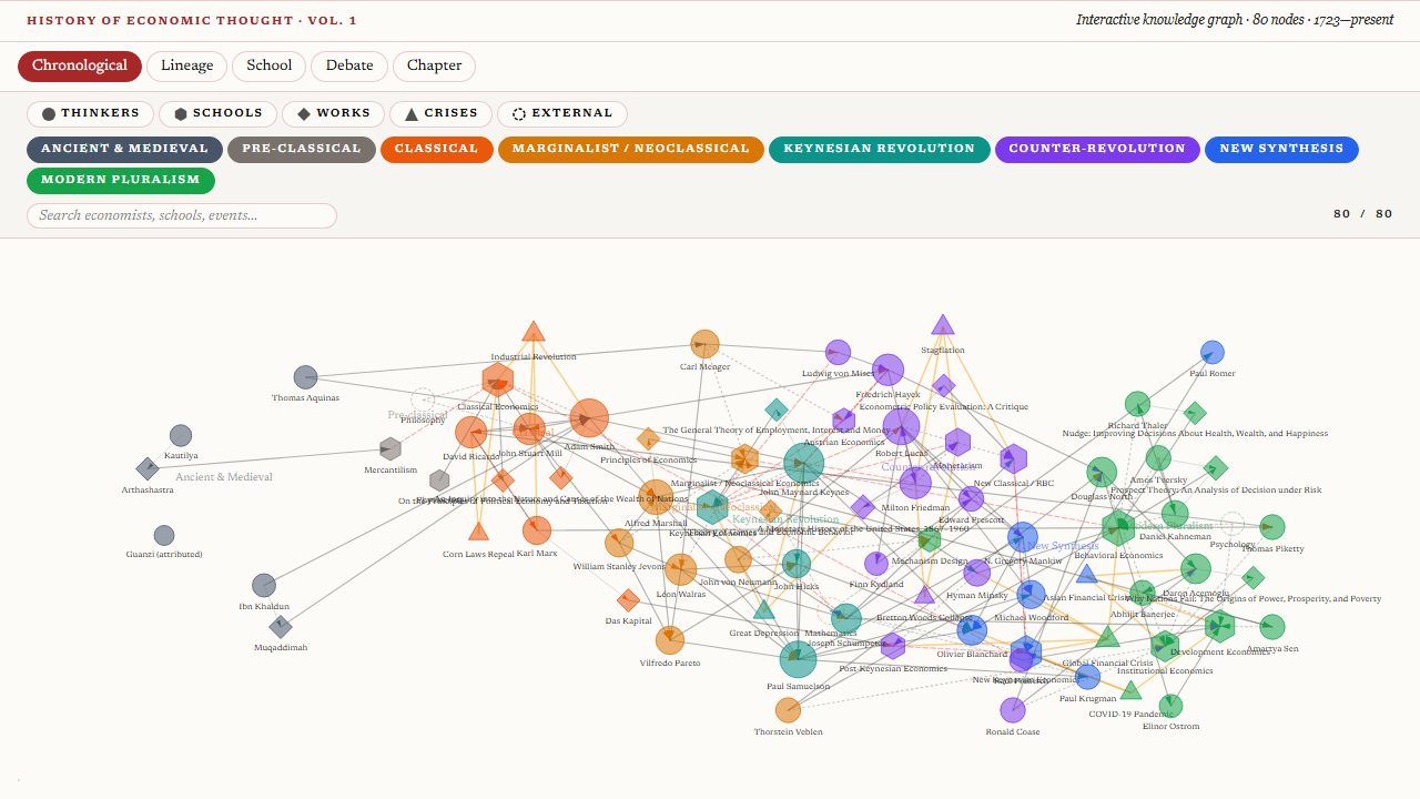
History of Economic Thought
Who influenced whom — Aquinas through Acemoglu
Choropleth
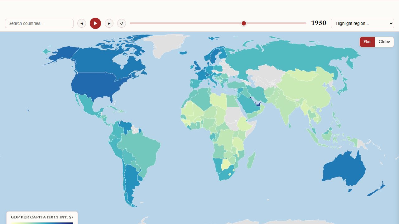
GDP per Capita Through History
Scrub from 1820 to today — flat or globe
Trade-route map
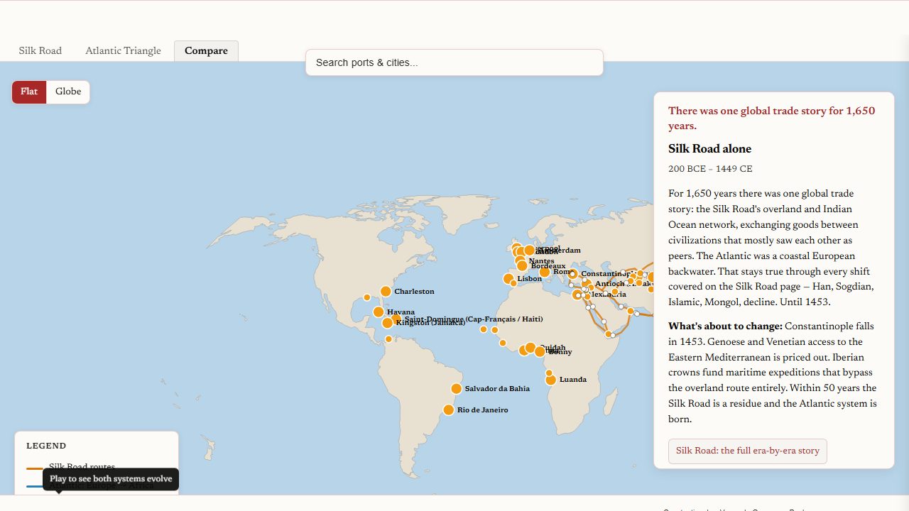
Trade Routes & Cities
Routes, cities, and eras — Silk Road and Atlantic
Language map
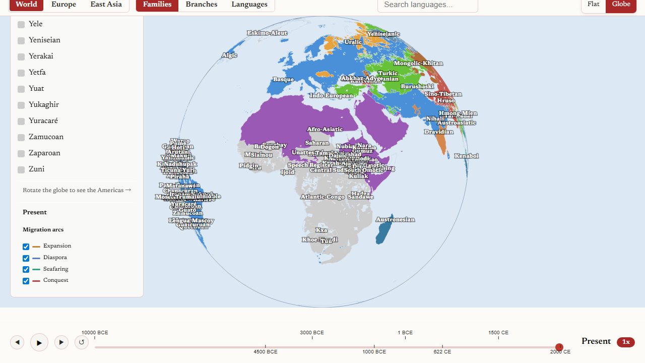
Language Families
Family geography and dispersal arcs, -10,000 to today
Layered chart
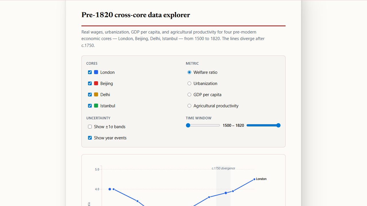
Pre-1820 Cross-Core Explorer
London, Beijing, Delhi, Istanbul — 1500 to 1820
Narrated campaign
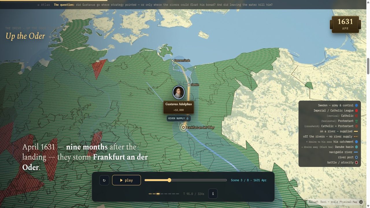
Gustavus Adolphus 1630–32
Where the bread can float — a narrated campaign, decided by rivers
More atlases will appear here as they ship. Each one lives inside a topic and earns a place here once it’s ready to read end-to-end.